


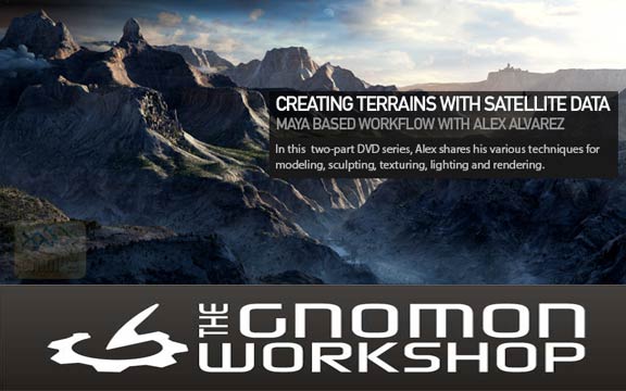
فیلم آموزشی Creating Terrains with Satellite Data vol 1 – 2 ، آموزش طراحی و ایجاد زمین با داده های ماهواره ای می باشد که توسط شرکت The Gnomon Workshop تهیه و در اختیار علاقمندان به اینگونه طراحی ها قرار گرفته است . در این فیلم آموزشی به چگونگی طراحی زمین با بکارگیری چند نرم افزار و استفاده از تصاویر و اطلاعات ماهواره ای می پردازند . Alex Alvarez که مدرس فیلم آموزشی Creating Terrains with Satellite Data vol 1 – 2 می باشد در ادامه روند این دوره به آموزش چگونگی استفاده از ابزار ها در هر یک از این نرم افزار ها و قابلیت های هر یک از این نرم افزار ها برای کمک در این طراحی خواهند پرداخت تا شما را بطور کامل با این مباحث آشنا نمایند .

مباحث مورد بحث در Creating Terrains with Satellite Data vol 1 :
– Google Earth Location Scouting
– Locating / Downloading Satellite Data
– Digital Elevation Models (DEMs)
– Stitching Satellite Data
– Removing Shadows
– Displacement Set-Up
– Height Field Utility
– Layered Textures
– Procedural Rock Bump Maps
– Working with multiple UV regions
– Multi-Resolution Tiles
موارد آموزشی این دوره :
– Introduction
– Google Earth
– National Map
– Global Mapper
– Photoshop
– PhysicalSunSky Setup
– Displacement Setup
– Visualizing Displacement
– Tuning Displacement
– Texture Res Bump Map
– ColorMap Overview
– Removing Shadows
– Visibility Distance
– Reflection
– Bump and ColorCorrection
– Key to Fill Ratio
– PhotographicSky Background
– Working with UV tiles
– 32k map to 8k tiles
– MultiResolution tiles
– Procedural Rock bump map
– Layered textures
– Gloss map finalEdit
– Conclusion
مباحث مورد بحث در Creating Terrains with Satellite Data vol 2 :
– Replacing DEM Regions with High-Res Geo
– Using ZBrush to isolate, retopo
– Sculpting with HD Geometry
– HD Normal Map Workflow
– Decimation Master / XNormal Workflow
– Downloading Data from Google Earth Pro
– Texture Cleanup with Mari
– Physical Sun/Sky versus HDR Lighting
– Atmospheric Effects
– Render Passes / Compositing
موارد آموزشی این دوره :
– Introduction
– Replacing Foreground Geo
– Foreground retopo uvs
– Foreground Integration part1
– Foreground Integration part2
– GoogleEarth textures part1
– GoogleEarth textures part2
– 16k projection workflow
– Foreground texture Final
– ZBrush Sculpting HD Geometry
– UpRezing whole Terrain 16k maps
– DEMs in ZBrush Xnormal
– Texture Cleanup with Mari
– PhysicalSunSky Limitations
– HDR lighting with Spot lights
– Fly Through
– Atmospheric Effects
– Trees and architecture
– Photoshop Comp
مشخصات دیگر فیلم آموزشی Creating Terrains with Satellite Data vol 1 – 2 :
– ژانر : آموزشی
– شرکت سازنده : The Gnomon Workshop
– مدرس : Alex Alvarez
– مدت زمان آموزش : 13 ساعت و 34 دقیقه
– پروژه ی تمرینی : ندارد
– زبان : انگلیسی
– کیفیت نمایش : 720 * 1280
– فرمت فایل : mp4
– زیرنویس فارسی : ندارد

لینک دانلود

سلام و خسته نباشید
برای باز کردن فایلها نیاز به پسورد هست اگه امکان داره راهنمایی کنید
با تشکر
سلام
دوست عزیز پسورد تمامی فایل ها www.download.ir می باشد که در ابتدای لینک های دانلود نوشته شده است.
ما را در تلگرام دنبال کنید
آقا دستتون درد نکنه جدا ندیدم ههه
ممنونم
سلام شما نوشتین دانلود اما لینک دانلود نیست
سلام دوست عزیز
سمت راست بالا داخل کادر سبز رنگ نوشته لینک دانلود
برروی اون کلیک کنید تا لینک های دانلود برای شما نمایش داده شود .